The PSLs are brewing, classes have begun, and those Halloween stores are opening again in random strip malls. All that’s left is checking out some beautiful fall colors. But it can be tricky to time trips around the foliage when you don’t know when the leaves will be at their most perfect.
Fortunately, smokymountains.com has come up with an ingenious way to help you dodge that uncertainty. Their Fall Foliage Map tells you what stage of change the leaves are at in any given region at any given time. It’s a highly complex algorithm that we’re not even going to pretend to understand, but the predictions have impressive accuracy. Year after year we’ve used this site to plan roadtrips to leaf peep and get fall content for social media.
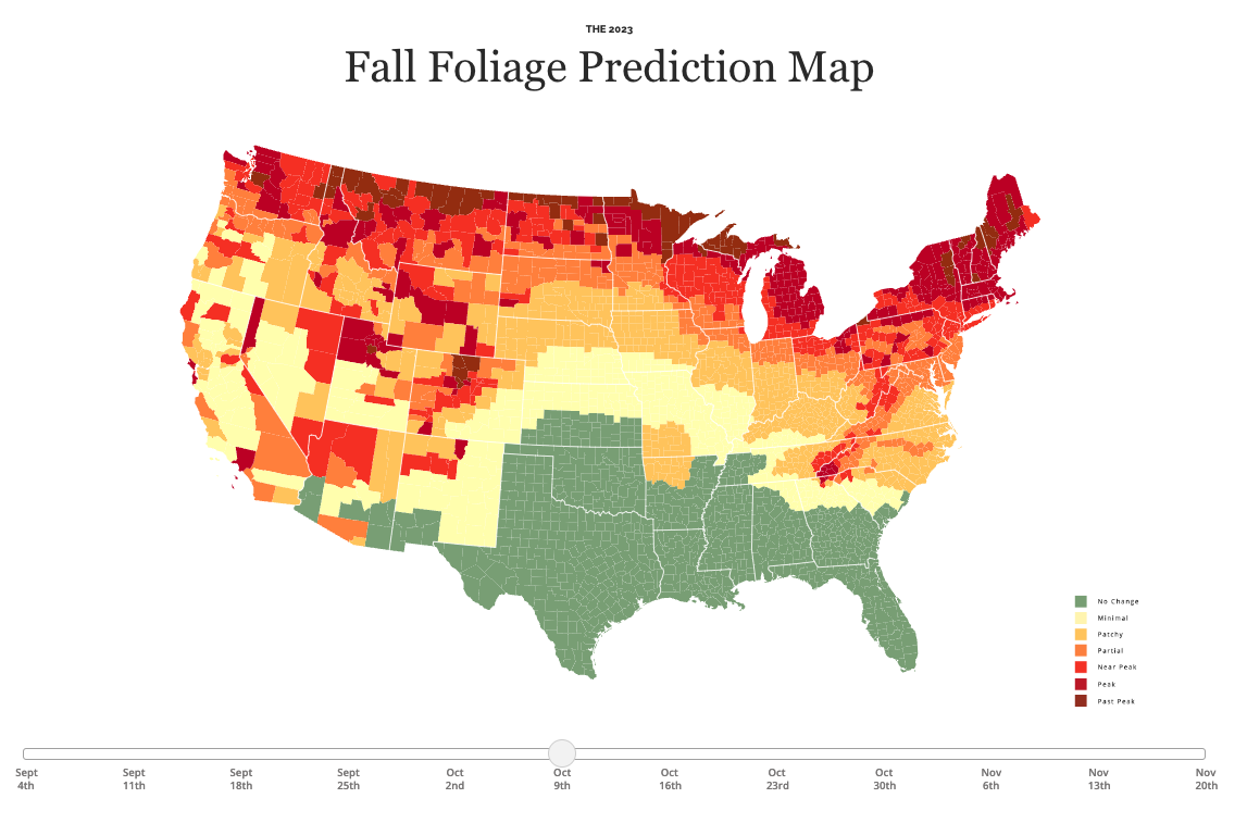
How does the foliage map work?
The date slider and color code show how far along the leave changes are predicted to be by county in the US. Green indicates that the leaves are, you guessed it, still green. The yellow, red, and brown show how much of the trees in the area will be in peak color.
When should you travel to see the leaves?
To see the best colors this year, plan to take your trip when it’s red, but don’t wait until it’s brown or you’ll find all the leaves on the ground. If you have an area in mind that you want to visit, simply use the date slider to figure out the best time to book your car rental or flights and accommodation. If you have a specific time you want to travel, use the date slider to figure out where you should be going that weekend.
Speaking to Travel + Leisure, the map’s creator, David Angotti, said: “In 2013, potential visitors to the Smoky Mountain region began asking us questions about when the leaves would be most brilliant. From these questions, we built the first version of the fall leaf map and have consistently improved it each year.
“What started as a fun side-project quickly became the most respected nationwide fall leaf map and one of the best fall resources in the country. Now, tens of millions of people use our map each year to plan vacations, weddings, and photography trips.”


